In today’s data-driven world, the role of a geospatial engineer has become increasingly crucial across various industries, from urban planning to environmental management. Geospatial engineers blend geography, data analysis, and technology to map and analyze spatial data. The skills required to excel in this field go far beyond basic geographic knowledge; they demand technical proficiency, analytical capabilities, and a strong understanding of spatial data.


Skills Required for Geospatial Engineers
The foundation of a successful career as a geospatial engineer lies in mastering a wide range of both technical and analytical skills. These skills allow professionals to handle geospatial data, solve complex spatial problems, and effectively collaborate with multidisciplinary teams.
Technical Skills for Geospatial Engineers
Proficiency in GIS Software
At the heart of a geospatial engineer’s skill set is the ability to use Geographic Information Systems (GIS) software. GIS tools such as ArcGIS, QGIS, and Google Earth Engine are fundamental in analyzing and visualizing spatial data. These tools allow geospatial engineers to create detailed maps, perform spatial analysis, and manage large datasets.
- ArcGIS: One of the most widely used platforms for spatial data analysis. It offers advanced tools for creating and editing maps, as well as running complex geospatial models.
- QGIS: An open-source alternative that is favored for its flexibility and extensive plugin ecosystem.
- Google Earth Engine: Provides cloud-based geospatial processing, allowing engineers to analyze global-scale datasets efficiently.
Learning to manipulate and analyze data using these software programs is essential because most geospatial tasks, such as land-use planning, disaster management, and environmental monitoring, depend on them.
Understanding of GPS and Remote Sensing
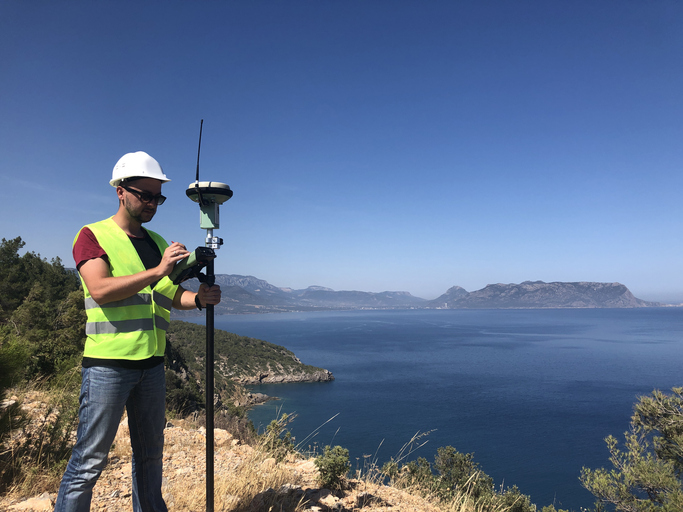
A thorough understanding of GPS (Global Positioning System) and remote sensing technologies is another key technical skill for geospatial engineers. GPS allows for precise location data collection, which is critical for projects involving navigation, land surveying, and even autonomous vehicles. Remote sensing, on the other hand, involves gathering data from satellites or aircraft to monitor the earth’s surface.
- Remote sensing technologies are particularly useful in environmental monitoring, such as tracking deforestation, urban sprawl, and climate change.
- GPS data is vital in industries like transportation and logistics, helping to optimize routes and track vehicles in real-time.
Cartography and Map Design
A strong grasp of cartography—the science of map-making—is essential. Geospatial engineers must understand how to present complex geospatial data in a visually clear and accurate manner. This involves knowing how to use scale, projection, and symbology to ensure that the map effectively communicates the intended information.
- Good map design is essential in fields like urban planning, where clear visuals are needed for stakeholders to make informed decisions about land use.
Programming and Automation Skills
Geospatial engineers need to be proficient in programming languages commonly used in data processing and geospatial analysis. Python is one of the most important languages, as it integrates well with GIS software and allows for automation of repetitive tasks. R is also widely used for statistical analysis of spatial data.
- For example, Python libraries such as Geopandas and Shapely are invaluable for automating spatial data processing tasks, which can save hours of manual work.
- Automation through APIs (Application Programming Interfaces) allows engineers to streamline data collection and integration, making their workflows more efficient.
In today’s fast-paced technological landscape, the ability to code is becoming increasingly important, enabling geospatial engineers to process large datasets, perform spatial analysis, and build custom tools tailored to specific needs.

Data Analysis and Interpretation Skills
While technical skills are fundamental, the ability to analyze and interpret data is equally important for geospatial engineers. A large part of the role involves making sense of spatial datasets and extracting meaningful insights. These insights are used to solve problems, inform decisions, and predict future trends.
Spatial Data Analysis
Spatial data analysis is at the heart of geospatial engineering. This process involves examining the relationships between objects based on their location in space. By understanding how things are distributed geographically, engineers can solve real-world problems in a wide range of fields, from transportation to environmental science.
- Spatial relationships: Geospatial engineers often deal with concepts like proximity, adjacency, and clustering to understand patterns. For example, in urban planning, spatial analysis can reveal which areas are underserved by public transportation, allowing planners to improve access.
- Spatial correlation: Understanding how one geographic feature relates to another is critical. For instance, by analyzing spatial correlations between deforestation and urban growth, geospatial engineers can help policymakers mitigate environmental impact.
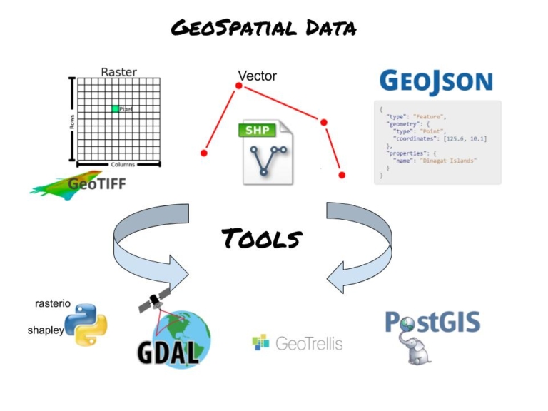
Spatial data analysis often involves the use of GIS software (such as ArcGIS or QGIS) to visualize, manipulate, and interpret large datasets. The ability to work with raster and vector data (the two primary types of spatial data) is crucial. Engineers must understand how to process and analyze these datasets to gain insights about land use, climate change, and more.
Example of Spatial Data Analysis in Action:
A geospatial engineer working for a city planning department might use spatial analysis to determine the best locations for new parks. By examining population density, proximity to existing green spaces, and environmental factors (like air quality), they can recommend areas where new parks would have the greatest positive impact.
Geostatistics
Geostatistics is a specialized area of spatial data analysis that involves statistical techniques applied to spatial or spatiotemporal data. Unlike traditional statistics, geostatistics takes into account the spatial relationships between data points. This makes it especially valuable for predicting trends and patterns across geographic areas.
- Kriging: One of the most commonly used geostatistical methods, kriging is used to predict the value of a variable at an unmeasured location based on known values from nearby locations. This technique is widely used in environmental science, particularly for predicting things like air pollution levels or groundwater contamination.
- Spatial interpolation: Another key geostatistical method, spatial interpolation involves estimating unknown values in a geographic area based on the values at known points. This technique is often used to fill gaps in datasets, such as estimating rainfall in areas where direct measurements are unavailable.
Understanding geostatistics is crucial for geospatial engineers because it allows them to make predictions and create models that can inform decision-making. For instance, predictive models based on spatial data can help governments plan for population growth, or assist environmental agencies in monitoring the spread of invasive species.
Case Study: Using Geostatistics for Environmental Monitoring
A geospatial engineer might use geostatistical methods to track the spread of pollutants in a river system. By collecting water quality data from various points along the river, the engineer can use kriging to predict pollution levels in areas where direct measurements are unavailable. This information can then be used to identify sources of pollution and take corrective action.

Problem-Solving and Critical Thinking Abilities
Geospatial engineers must possess strong problem-solving and critical thinking skills. These abilities allow them to tackle complex spatial challenges by applying both analytical and creative approaches. Whether solving environmental issues, optimizing logistics, or aiding in disaster management, the ability to think critically about spatial problems is crucial.
Analytical Problem-Solving
Analytical problem-solving is the cornerstone of a geospatial engineer’s work. Engineers often encounter problems that require deep analysis of spatial relationships and patterns to identify the best solution. By using spatial data, they can create models that provide valuable insights into real-world issues.
- Example in urban planning: A city government may need to develop an efficient public transportation network. A geospatial engineer can analyze population density, existing transit routes, and travel patterns to recommend optimal locations for new bus or subway lines.
- Environmental management: Engineers can use spatial data to identify areas most vulnerable to natural disasters, such as flooding or landslides, and suggest preventive measures like better drainage systems or stronger building regulations.
The problem-solving process often involves breaking down large datasets, identifying key variables, and testing different scenarios. By doing so, geospatial engineers can offer data-driven solutions that are not only effective but also cost-efficient.
Real-World Application: Solving Traffic Congestion in a City
A geospatial engineer might be tasked with addressing traffic congestion in a rapidly growing city. By collecting data on traffic patterns, road networks, and population distribution, they could run spatial simulations to identify bottlenecks. Using this data, they can recommend infrastructure improvements, such as expanding certain roads or introducing new traffic light systems to ease congestion.
Spatial Thinking
Spatial thinking is the ability to understand and reason about the spatial relationships between objects. For geospatial engineers, this is an essential cognitive skill because much of their work involves interpreting the arrangement of objects in space and making decisions based on those relationships.
- Spatial reasoning: Engineers use spatial reasoning to solve geographic problems such as how to best allocate resources across a landscape or how to optimize the placement of infrastructure like roads, bridges, or pipelines.
- Geospatial patterns: Recognizing patterns in spatial data is crucial. For example, spatial clustering might reveal areas with a high concentration of pollution, which can then be targeted for remediation.
Spatial thinking also involves visualizing spatial data in different formats—whether in the form of maps, charts, or 3D models—and understanding how those visuals represent real-world phenomena. This skill helps geospatial engineers communicate their findings more effectively to non-technical stakeholders.
Case Study: Spatial Thinking in Emergency Management
In disaster response, spatial thinking allows engineers to determine where to allocate resources most efficiently. For example, during a natural disaster like a hurricane, engineers must quickly analyze which areas are most affected, which routes are still passable, and where to establish relief centers. By thinking spatially, geospatial engineers can help coordinate emergency responses that save lives and reduce damage.
Problem-solving and spatial thinking are indispensable skills for geospatial engineers. Whether it’s optimizing urban infrastructure, mitigating environmental impacts, or coordinating disaster responses, these abilities enable engineers to find effective solutions to complex geographic problems. In many cases, their solutions directly impact the quality of life for people living in affected areas, making these skills not only technical but also deeply human-centered.

Communication and Collaboration Skills
While technical proficiency and problem-solving abilities are critical for geospatial engineers, the importance of communication and collaboration skills cannot be overstated. Engineers often work with multidisciplinary teams and must convey complex data and findings to non-technical stakeholders in a clear and understandable manner.
Translating Complex Data into Understandable Insights
One of the key challenges for geospatial engineers is translating complex geospatial data into actionable insights that are easily understood by diverse audiences. Geospatial data, by its nature, can be highly detailed and technical, often involving layers of geographic information, statistical analysis, and intricate visualizations.
- Visual communication: Geospatial engineers frequently use maps, charts, and infographics to present data in a way that is visually intuitive. For example, a heatmap showing areas of high traffic congestion can quickly communicate issues to city planners without requiring them to dive into raw datasets.
- Tailoring messages to different audiences: A geospatial engineer may need to explain the same data differently depending on the audience. A detailed statistical report might be suitable for other engineers or scientists, while a simplified visual presentation may be needed for decision-makers or the public. For instance, a local government might only need a high-level summary of how new construction projects will impact urban sprawl, rather than the granular geospatial analysis behind it.
Good communication ensures that the data generated by geospatial engineers leads to informed decision-making and actionable steps. This can be particularly important in high-stakes situations, such as disaster response or infrastructure development, where timely and accurate information is essential.
Example: Communicating Climate Data to Policymakers
Consider a situation where a geospatial engineer is tasked with assessing the impact of climate change on coastal regions. The technical analysis may involve complex datasets related to sea-level rise, coastal erosion, and flood risk. However, the findings need to be communicated to policymakers in a way that highlights the urgency and the areas most at risk, possibly using maps that clearly show vulnerable zones and projections of future changes.
Teamwork in Multidisciplinary Environments
Collaboration is another critical skill for geospatial engineers. The nature of their work often requires them to work alongside professionals from different fields, including environmental scientists, urban planners, civil engineers, software developers, and policymakers. The ability to collaborate effectively within these multidisciplinary teams ensures that geospatial insights are fully integrated into broader projects and solutions.
- Interdisciplinary collaboration: For instance, in large infrastructure projects, a geospatial engineer might work with civil engineers to ensure that proposed structures (roads, bridges, etc.) are optimized for the landscape. Similarly, when dealing with environmental issues, geospatial engineers collaborate with biologists or environmental scientists to assess the impact of human activities on natural habitats.
- Facilitating communication between disciplines: Geospatial engineers often act as intermediaries between different departments, ensuring that spatial data is shared and understood by everyone involved. For example, when developing a new urban area, the engineer might collaborate with both real estate developers and environmental experts to balance economic development with environmental conservation.
Case Study: Collaboration in Urban Planning
In an urban planning project, a geospatial engineer might work with a team that includes architects, transportation planners, and local government officials. The engineer’s role would be to provide data on current land use, population density, and transportation flows. By collaborating with other experts, the engineer helps design a city layout that promotes efficient transportation, minimizes environmental impact, and meets the needs of the growing population.