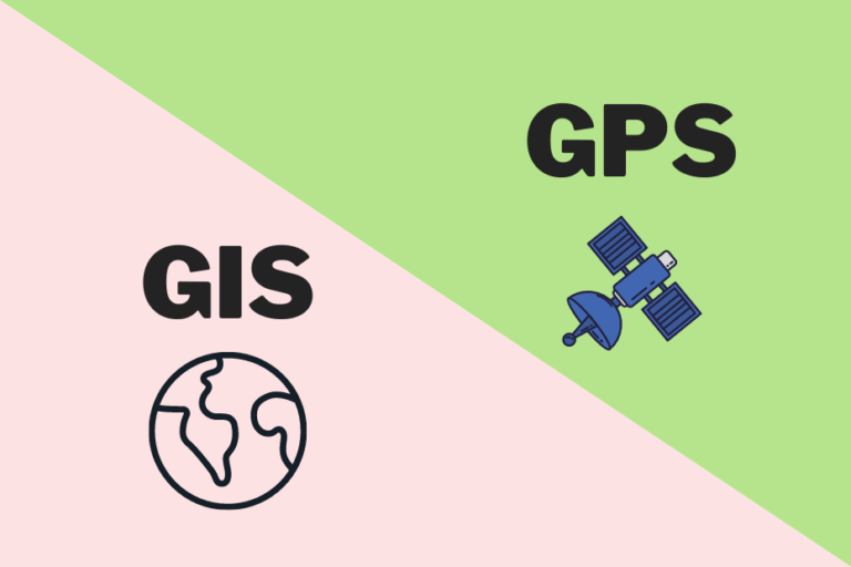
With the rapid growth of location-based technologies, the terms GPS and GIS are often used interchangeably. However, despite their overlap in function, GPS and GIS are not the same. Each serves a unique purpose, and understanding their differences can help businesses, professionals, and individuals leverage these tools more effectively.
GPS, short for Global Positioning System, is a satellite-based navigation system designed to determine the precise location of objects on Earth. Originally developed by the United States Department of Defense in the 1970s for military use, it was later made available for civilian applications, transforming the way we navigate the world.
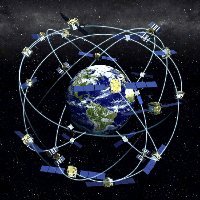
GPS relies on a network of 24 satellites orbiting the Earth, constantly transmitting signals to ground-based receivers. Using a technique called triangulation, GPS receivers determine their exact location based on the time it takes for signals to travel from multiple satellites. These satellites cover the entire globe, ensuring GPS access anywhere on Earth.
How GPS Works
- Satellites: At least 24 satellites orbit the Earth in different paths. A GPS receiver needs data from a minimum of three satellites to determine its 2D position (latitude and longitude). For 3D positioning (including altitude), four satellites are required.
- Receiver: A GPS receiver, such as the one in your phone, processes signals from satellites to calculate the distance to each satellite.
- Triangulation: Using the data from multiple satellites, the receiver computes its precise geographic location.
This system provides real-time location data, giving latitude, longitude, and sometimes elevation or speed.
What GPS Is Used For?
GPS has become essential in everyday activities, and it plays a critical role in numerous industries. Some key uses include:
Personal and Everyday Uses
- Navigation: GPS helps drivers find their way, avoiding traffic and reaching destinations faster.
- Smartphones: Most modern phones come with GPS, which supports apps like Google Maps and Uber.
- Fitness Trackers: Runners and cyclists use GPS-enabled devices to track distance, speed, and routes.
- Location Sharing: GPS powers services like Find My iPhone and location tagging in social media apps.
Professional and Industry Applications
- Aviation and Maritime Navigation: Pilots and ship captains rely on GPS for route planning and positioning.
- Military Operations: GPS ensures precision targeting and troop movements in remote areas.
- Surveying and Construction: Surveyors use GPS for accurate measurements of land boundaries.
- Fleet Management: Logistics companies track delivery vehicles in real-time for efficient operations.
Offline GPS Functionality
One of the most practical benefits of GPS is that it can work without an internet connection. This is especially helpful in remote areas where mobile networks are unavailable. As long as the device has line-of-sight access to satellites, GPS will function smoothly.

While GPS is primarily used to pinpoint locations, GIS (Geographic Information System) goes far beyond that by managing, analyzing, and visualizing spatial data. GIS is a computer-based system designed to capture, store, analyze, and present data related to positions on the Earth’s surface. Essentially, GIS allows us to layer different types of data on a map, making it a powerful tool for analyzing patterns, trends, and relationships.
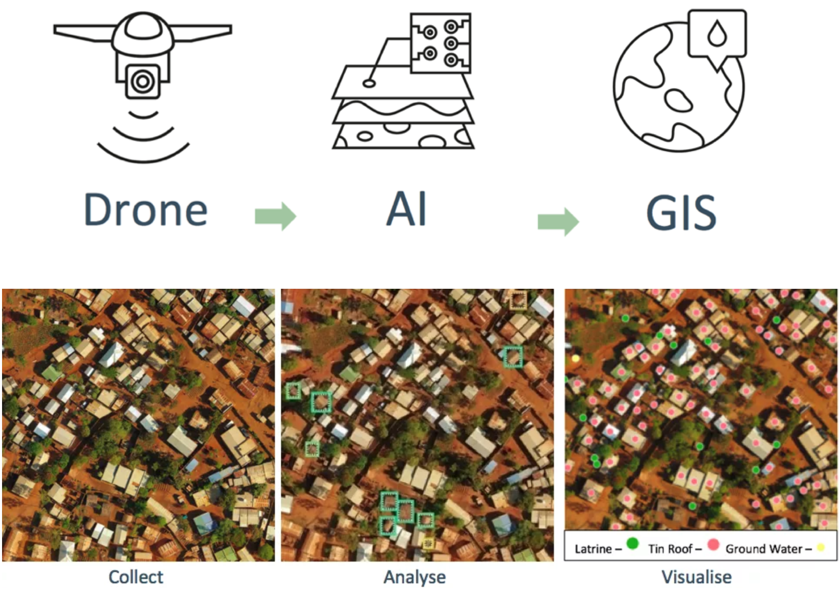
GIS integrates spatial data (like maps, satellite images, or GPS coordinates) with attribute data (like population statistics, weather information, or traffic conditions). This combination makes GIS ideal for decision-making and problem-solving across various fields.
A good way to think of GIS is that it answers questions related to geography, such as:
- Where are the most flood-prone areas in a city?
- How does air quality vary across different neighborhoods?
- What’s the best route to optimize delivery operations?
How GIS Works
GIS systems are made up of several components:
- Data Collection: Data for GIS can come from GPS devices, satellite imagery, sensors, or databases.
- Software Platforms: GIS platforms, like ArcGIS or QGIS, process and analyze spatial data.
- Data Layers: Information is organized in layers—for example, one layer for roads, another for population, and another for water bodies.
- Visualization: GIS presents data on interactive maps or 3D models, allowing users to explore different relationships and patterns.
- Analysis Tools: Advanced GIS tools help users perform geospatial analysis, such as calculating distances, predicting future trends, or finding the shortest path between points.
Here is an example of how layered GIS data looks:
| Layer | Description |
|---|---|
| Roads Layer | Displays roads, highways, and paths |
| Elevation Layer | Shows changes in terrain and altitude |
| Population Layer | Maps population density or demographics |
| Water Sources Layer | Highlights lakes, rivers, and reservoirs |
These layers work together to create rich, interactive maps that help solve real-world challenges.
What GIS Is Used For?
GIS finds applications across multiple fields, particularly in industries where spatial analysis is essential. Below are some of the key areas where GIS is widely used:
Environmental Monitoring and Management
- Pollution Tracking: GIS maps can show areas with high levels of air or water pollution, helping officials target cleanup efforts.
- Wildlife Conservation: Scientists use GIS to map the movement of endangered species and plan protective zones.
- Disaster Management: GIS helps emergency responders plan evacuation routes and locate areas at risk from natural disasters like floods, hurricanes, and wildfires.
Urban Planning and Infrastructure Development
- Land-Use Planning: Urban planners use GIS to allocate land for residential, commercial, or industrial development.
- Infrastructure Mapping: GIS helps track the location of utilities such as water lines, electric grids, and transportation networks.
- Public Transit Optimization: Transit agencies rely on GIS to analyze travel patterns and design efficient bus or subway routes.
Business Applications
- Retail Site Selection: Businesses use GIS to identify the best locations for new stores based on factors like population density, traffic flow, and competition.
- Logistics and Supply Chain: GIS helps companies manage delivery routes and minimize transportation costs.
- Marketing Campaigns: Marketers use GIS data to identify target audiences based on geographic patterns.
Agriculture and Land Management
- Precision Agriculture: Farmers use GIS to monitor soil conditions and optimize crop planting based on terrain and moisture levels.
- Forest Management: GIS maps track forest cover changes and identify areas suitable for reforestation efforts.
GIS Tools and Software
Some popular GIS platforms used by professionals include:
- ArcGIS: Developed by Esri, this is one of the most widely used GIS platforms.
- QGIS: A free, open-source alternative to ArcGIS, commonly used for smaller projects.
- Google Earth: Allows users to visualize spatial data on a global scale, although its GIS capabilities are limited.
- Mapbox: A mapping platform focused on real-time data visualization and custom mapping.
Real-World Example: Using GIS for Flood Risk Analysis
Imagine a city that wants to predict areas most at risk during heavy rainfall. With GIS, officials can:
- Overlay data layers such as rainfall forecasts, elevation maps, and drainage systems.
- Analyze historical flood patterns to identify high-risk zones.
- Create interactive flood maps that can be shared with the public to improve awareness and preparedness.
This type of analysis would be impossible with GPS alone, showcasing the analytical power of GIS.
GIS is essential for visualizing, understanding, and analyzing spatial relationships. While GPS provides location data, GIS takes that data a step further by integrating and analyzing it for deeper insights.

GPS vs. GIS: Key Differences
Now that we’ve explored GPS and GIS individually, let’s dive into their differences. While both technologies involve location-based data, they serve distinct purposes.
Core Differences Between GPS and GIS
| Aspect | GPS (Global Positioning System) | GIS (Geographic Information System) |
|---|---|---|
| Function | Determines exact geographic location (latitude, longitude, altitude). | Captures, stores, analyzes, and visualizes spatial data. |
| Purpose | Used primarily for navigation and tracking. | Used for data analysis, decision-making, and planning. |
| Data Type | Provides real-time coordinates from satellites. | Combines multiple data layers for complex analysis. |
| Technology | Requires satellite signals and a receiver (e.g., smartphone). | Involves software, databases, and spatial data layers. |
| Examples | Navigating with Google Maps or tracking a package’s delivery. | Analyzing flood risks or creating zoning maps for urban planning. |
How GPS and GIS Work Together
Though GPS and GIS are not the same, they frequently complement each other. GIS relies on GPS data to enhance maps with precise coordinates, making GPS critical for many GIS applications. Here are some examples of how both systems work hand-in-hand across various industries:
Agriculture: Precision Farming
- GPS Use: GPS-equipped tractors follow precise paths to avoid overlapping when planting seeds or applying fertilizer.
- GIS Use: GIS maps analyze soil quality, moisture levels, and topography to recommend optimal planting strategies.
- Outcome: Farmers achieve higher yields with lower costs by combining GPS-guided machinery with GIS analysis.
Logistics and Transportation
- GPS Use: Fleet managers use GPS to track trucks and delivery vehicles in real-time.
- GIS Use: GIS identifies the best routes based on road conditions, traffic data, and weather forecasts.
- Outcome: Companies reduce fuel costs and improve delivery times by combining GPS tracking with GIS route optimization.
Emergency and Disaster Management
- GPS Use: First responders track their exact locations and movements using GPS during rescue missions.
- GIS Use: GIS maps display affected areas, helping responders prioritize rescue operations based on population density or infrastructure damage.
- Outcome: Faster response times and better resource allocation during natural disasters.
Why GPS and GIS Are Often Confused
The confusion between GPS and GIS arises because both systems are related to location. However, understanding that GPS provides data (the “where”), while GIS analyzes and visualizes that data (the “what” and “why”), clears up much of the overlap.
Examples of Distinction in Everyday Life
- Using GPS Alone: When you drive with Google Maps and it shows your current position on the road, you are using GPS to navigate.
- Using GIS with GPS Data: When a city analyzes traffic congestion trends over time using GPS tracking data from vehicles, it’s applying GIS for planning purposes.
When to Use GPS vs. GIS
It’s helpful to know which technology to rely on based on your specific needs:
- Use GPS when:
- You need real-time location information (e.g., during travel or for fitness tracking).
- Navigation or position tracking is the primary goal.
- Use GIS when:
- You need to analyze spatial data and see patterns (e.g., planning new infrastructure).
- Your work requires layered geographic insights (e.g., environmental studies or business location analysis).
Key Takeaway: Are GPS and GIS the Same?
No, GPS and GIS are not the same, but they complement each other beautifully. GPS provides the raw location data, while GIS processes and analyzes that data to extract meaningful insights. Many industries use both tools together to improve efficiency and make better decisions.

How GPS and GIS Work Together in Real-World Applications
GPS and GIS are powerful tools on their own, but when combined, they unlock even greater possibilities. Many industries rely on both systems to streamline operations, improve decision-making, and create more efficient workflows.
Agriculture: Precision Farming
The agricultural sector has transformed with the adoption of GPS-guided machinery and GIS-powered data analysis.
- How GPS Is Used: GPS-enabled tractors automatically navigate farmland in straight lines, preventing overlaps or gaps during seeding and fertilizer application.
- How GIS Is Used: GIS maps analyze soil health, moisture levels, and crop yield patterns, helping farmers optimize planting and irrigation.
- Outcome: Farmers save on labor, fuel, and resources while increasing crop productivity by targeting specific areas for treatment based on GIS insights.
Example: A corn farmer in the Midwest uses GPS to steer his tractor and GIS maps to apply fertilizer only where the soil’s nutrient levels are low, minimizing waste and environmental impact.
Logistics and Fleet Management
In logistics, combining GPS with GIS is essential for managing large fleets of delivery trucks and optimizing routes.
- How GPS Is Used: GPS devices installed in trucks track their exact location and movement in real-time, giving fleet managers complete visibility.
- How GIS Is Used: GIS software maps traffic patterns, weather conditions, and road closures to recommend the most efficient delivery routes.
- Outcome: Companies reduce fuel consumption, delivery time, and operational costs by planning routes that avoid delays and unnecessary mileage.
Example: Amazon uses GPS to track delivery vans and GIS to analyze traffic congestion in urban areas, rerouting drivers to avoid delays and improve customer satisfaction.
Emergency Response and Disaster Management
During emergencies, the combination of GPS and GIS saves lives by helping responders reach people faster and coordinate rescue operations efficiently.
- How GPS Is Used: Rescue teams use GPS to track their own locations and those of other responders in real time, ensuring efficient team coordination.
- How GIS Is Used: GIS maps identify flooded areas, earthquake zones, and high-risk locations, helping emergency coordinators prioritize resources and evacuation routes.
- Outcome: Faster, more effective response during disasters by targeting the areas in greatest need and deploying resources optimally.
Example: During Hurricane Katrina, responders used GPS for real-time tracking and GIS to map flooded neighborhoods, ensuring swift rescue efforts in the worst-hit areas.
Urban Planning and Infrastructure Development
Urban planners rely on GPS and GIS to design smart cities and develop infrastructure that meets community needs.
- How GPS Is Used: Surveyors use GPS to mark land boundaries and infrastructure points with high precision, ensuring accurate construction projects.
- How GIS Is Used: GIS maps provide a comprehensive view of land use, population density, and environmental factors, helping planners make informed decisions.
- Outcome: Cities grow more sustainably, with infrastructure that aligns with population needs and environmental goals.
Example: A city planner in San Francisco uses GPS to map property boundaries and GIS to analyze public transportation usage, ensuring new rail lines are built where demand is highest.
Wildlife Conservation and Environmental Monitoring
Scientists and environmentalists use GPS tracking devices and GIS mapping tools to monitor wildlife movements and manage natural resources.
- How GPS Is Used: Animals are fitted with GPS collars to track their migration patterns and behavior in real-time.
- How GIS Is Used: GIS analyzes the animal tracking data alongside environmental data (like vegetation maps and water sources) to identify critical habitats.
- Outcome: Conservation efforts become more targeted, protecting endangered species by preserving the areas they rely on most.
Example: Researchers tracking elephants in Africa use GPS collars to map migration routes. GIS analysis helps identify areas prone to human-wildlife conflict, guiding the creation of wildlife corridors to reduce these interactions.
Sports and Fitness Tracking
Even in the world of sports and fitness, the combination of GPS and GIS plays a role in helping athletes improve performance and track their progress.
- How GPS Is Used: Runners, cyclists, and hikers use GPS-enabled fitness devices to track their distance, speed, and elevation.
- How GIS Is Used: GIS analyzes the terrain and environmental conditions along the route, offering insights into elevation changes or challenging areas.
- Outcome: Athletes can adjust their training plans based on GIS data, improving their performance on future runs or rides.
Example: A marathon runner uses a GPS watch to track their pace and distance during training. Afterward, GIS software provides detailed maps of the route, showing where elevation gains slowed them down.
As these examples show, GPS and GIS are deeply intertwined in many industries. While GPS provides real-time location data, GIS adds depth to that data, offering insights that improve efficiency, sustainability, and safety. Whether it’s tracking wildlife, responding to emergencies, or planning city infrastructure, the combination of GPS and GIS creates smarter solutions to complex problems.