In today’s data-driven world, Geographic Information Systems (GIS) and geospatial data are critical to everything from urban planning to environmental conservation. However, many people use these terms interchangeably, leading to confusion. So, is GIS the same as geospatial data? The short answer is no—GIS and geospatial data are closely related but serve very different roles.
What Is GIS (Geographic Information System)?
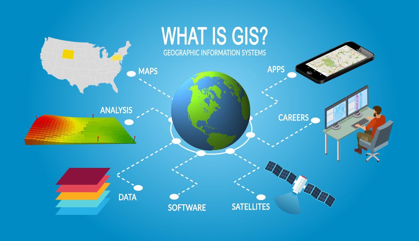
A Geographic Information System (GIS) is a framework used to capture, store, manipulate, analyze, manage, and present all types of geographical data. In simple terms, GIS enables users to create maps and visual representations of spatial data. This system combines hardware, software, and people to make sense of geographic data.
Key Components of GIS:
- Spatial data: The foundation of GIS, including location-based information such as coordinates, addresses, or other geographical identifiers.
- Tools: Software and applications that allow users to process, analyze, and visualize the spatial data.
- People: Users of the system who interpret the data and make decisions based on the information provided.
A typical GIS consists of:
- Data input (such as satellite images or survey data)
- Data management (databases that organize and store the data)
- Analysis tools (software that performs calculations, measurements, and interpretations)
- Output formats (such as maps, reports, and charts)
What Are the Uses of GIS?
GIS is used in various industries, from government to transportation. Below are some examples of its practical applications:
- Urban Planning: City planners use GIS to map infrastructure, land use, and population growth trends to make informed decisions on zoning and development.
- Environmental Management: GIS helps track deforestation, wildlife habitats, and the effects of climate change by analyzing geospatial data over time.
- Disaster Response: During natural disasters like earthquakes or floods, GIS is used to map affected areas, assess damage, and plan emergency response routes.
- Business & Marketing: Companies use GIS to analyze customer locations, market trends, and logistics, optimizing routes and services.
- Health and Epidemiology: GIS plays a vital role in tracking disease outbreaks, like COVID-19, by visualizing where cases are concentrated and how they spread.
GIS is also widely used in transportation (to manage routes and schedules), real estate (to analyze property values), and agriculture (to track crop health and optimize land use).

What Is Geospatial Data?
At its core, geospatial data refers to any data that is related to a specific location on Earth. This type of data includes information that has a geographic aspect, such as coordinates, addresses, or boundaries. It provides the critical “where” factor in data analysis, allowing for precise mapping and spatial analysis.
Components of Geospatial Data:
- Location data – This is the most fundamental aspect of geospatial data and is often expressed as coordinates (latitude and longitude) or other geographic markers.
- Attribute data – This includes information about the characteristics of a location, such as population, land use, or climate conditions.
- Temporal data – Geospatial data can also include a time component, tracking changes over days, months, or years.
Geospatial data is typically categorized into two types:
- Vector Data: This type of geospatial data represents features on the Earth’s surface as points, lines, and polygons. For example, a point could represent a specific landmark, a line could represent a road, and a polygon might represent a city or region.
- Raster Data: Raster data is made up of pixels or grid cells, commonly used for imagery like satellite photos or digital elevation models. Each pixel contains specific information about the area it represents.
Examples of Geospatial Data:
- Satellite images from Earth observation satellites provide detailed visuals of land use, vegetation, and weather patterns.
- GPS coordinates give precise location data used in navigation and mapping systems.
- Aerial photography collected from drones or planes for land surveying, agriculture, or real estate development.
- Street addresses used in logistics and transportation for route optimization.
How Is Geospatial Data Collected?
Geospatial data is collected from a variety of sources using advanced technologies. Below are some of the primary methods of geospatial data collection:
- Remote Sensing: Remote sensing uses satellites or aircraft to gather data about the Earth’s surface. This includes multispectral imaging, which captures data across different wavelengths to detect changes in vegetation, land use, or water bodies.
- GPS (Global Positioning System): GPS technology relies on satellites to pinpoint exact locations on Earth. It is widely used in navigation, mapping, and even in mobile apps like Google Maps.
- Aerial Photography: High-resolution images are captured from drones, planes, or helicopters for various purposes, such as construction planning, agriculture, or natural resource management.
- Ground Surveys: This method involves physical data collection by surveyors using specialized equipment to gather accurate information about land features, boundaries, or topography.
These methods provide data in raw forms that must be processed, organized, and analyzed to become useful in applications like GIS.

What Is the Relationship Between GIS and Geospatial Data?
While GIS and geospatial data are distinct, they are closely connected and dependent on each other. In fact, GIS cannot function without geospatial data, as it forms the raw material that GIS analyzes, visualizes, and manipulates.
To put it simply, geospatial data provides the “what” and “where” — it is the information about physical locations or geographic features on Earth. On the other hand, GIS is the system that allows this data to be processed, analyzed, and turned into meaningful insights. Without geospatial data, GIS would have no input to work with, and without GIS, raw geospatial data would remain underutilized.
How GIS Uses Geospatial Data:
- Data Input and Management: GIS systems are designed to import large sets of geospatial data from various sources (such as satellite imagery or GPS coordinates). This data is stored in databases, where it can be accessed and used for analysis.
- Spatial Analysis: GIS tools analyze geospatial data to uncover patterns and relationships between different geographical factors. For example, GIS can be used to identify areas prone to flooding by analyzing terrain data and rainfall patterns.
- Visualization: One of the most powerful features of GIS is its ability to create maps and other visual representations of geospatial data. For instance, real-time traffic maps use geospatial data to display road congestion, giving users a clear picture of where delays are occurring.
- Decision-Making and Planning: By analyzing geospatial data, GIS helps governments, businesses, and organizations make informed decisions. For example, a city planner might use GIS to analyze population growth trends and determine where new infrastructure is needed.
Case Study: GIS and Disaster Management One of the most compelling examples of GIS using geospatial data is in disaster management. After a hurricane or earthquake, GIS systems are used to map the affected areas by analyzing geospatial data from satellites and drones. This helps emergency services identify which regions are most in need of relief, prioritize resources, and create evacuation routes. Without GIS, geospatial data from these sources would be scattered and difficult to interpret.
Can GIS Exist Without Geospatial Data?
The short answer is no—GIS is entirely dependent on geospatial data. Without this data, GIS systems would lack the necessary inputs to perform spatial analysis or generate maps. Geospatial data is the fuel that powers GIS, giving it the capacity to model and analyze real-world conditions.
While GIS can incorporate other forms of data, such as demographic or economic data, it must still be connected to geospatial data in some way. For instance, an economic dataset showing income levels across different neighborhoods would need to be tied to specific geographic locations (geospatial data) for a GIS to analyze it spatially.

What Is the Difference Between GIS and Geospatial Data?
Although GIS and geospatial data are often used together, they are fundamentally different in terms of their roles and functions. Understanding the distinctions between these two concepts is key to fully grasping how spatial analysis and mapping technologies work.
Key Differences Between GIS and Geospatial Data
| Aspect | GIS (Geographic Information System) | Geospatial Data |
|---|---|---|
| Definition | A system designed to capture, store, manipulate, and analyze geographical data | Data that includes information about the location and features on Earth |
| Role | A tool or framework used to analyze and visualize spatial data | The raw information about geographic locations and features |
| Components | Includes hardware, software, and human expertise | Includes coordinates, attributes, and spatial references |
| Usage | Used for decision-making, mapping, and spatial analysis | Used as input for GIS and other spatial analysis tools |
| Examples | Software like ArcGIS, QGIS, Google Earth | Satellite imagery, GPS data, digital maps |
GIS as a System As a system, GIS is a complete framework involving not just data but also the tools and expertise required to make sense of that data. It includes several components, such as data storage systems, analysis tools, and a user interface for visualization. GIS allows users to interact with geospatial data and create meaningful insights through maps, reports, and models.
Geospatial Data as Information On the other hand, geospatial data is the raw information. It may include data points like the latitude and longitude of a location, elevation levels, or land use classifications. This data can exist in various formats, such as spreadsheets, databases, or even images. Without a GIS or another tool to process and analyze it, geospatial data on its own has limited practical use.
Why Understanding the Difference Matters
Understanding the difference between GIS and geospatial data is crucial for professionals in many fields, including urban planning, environmental management, and transportation. Here are a few reasons why recognizing this distinction is important:
- Better Decision-Making: Knowing the difference helps users choose the right tools for their specific needs. While geospatial data is essential, GIS tools are what allow this data to be analyzed and visualized effectively.
- Efficient Data Management: Professionals can make more informed decisions about data storage and processing. For instance, a large set of geospatial data might require specific GIS software to manage and analyze it properly.
- Enhanced Collaboration: Understanding the roles of GIS and geospatial data helps facilitate better communication among multidisciplinary teams, ensuring that data analysts, cartographers, and decision-makers are on the same page.