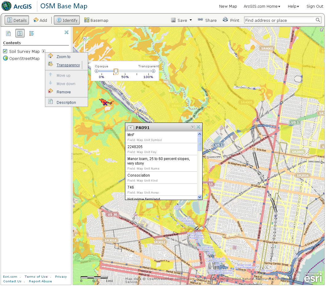
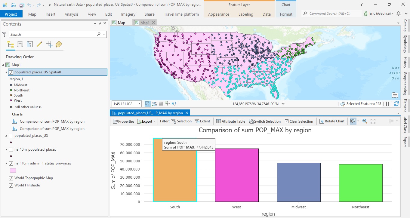
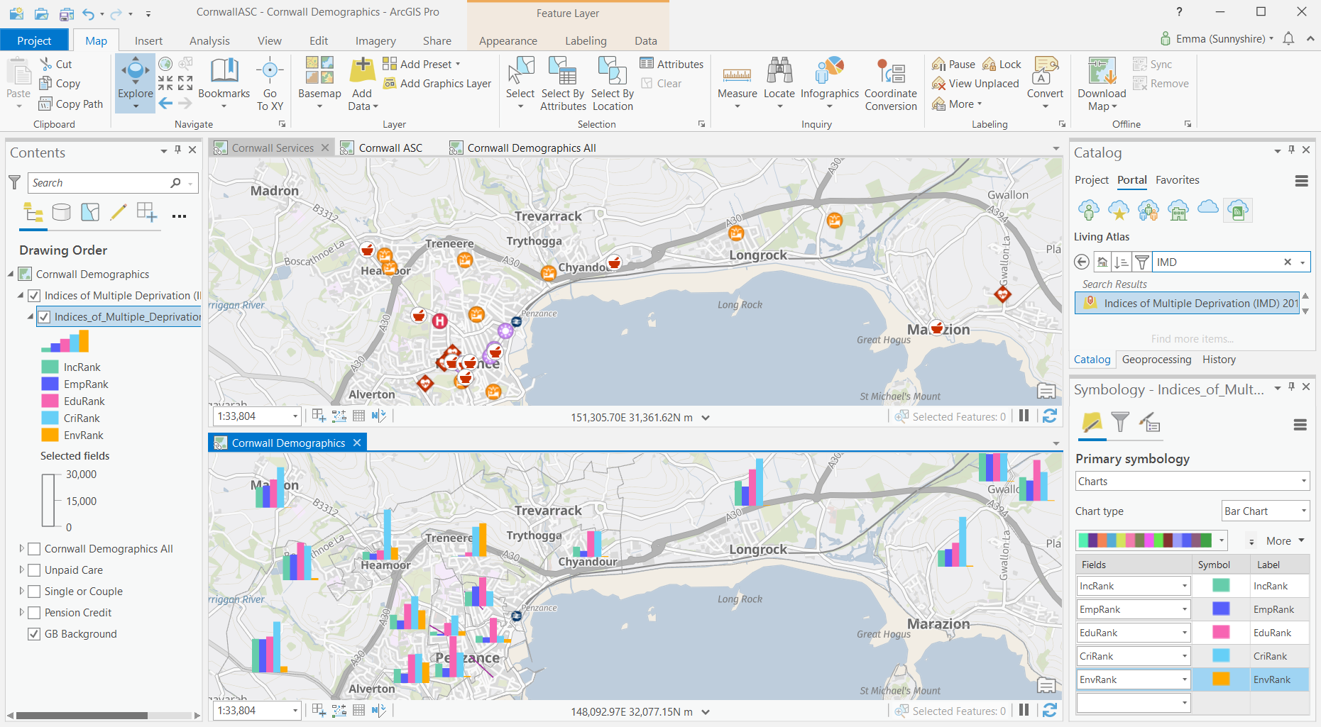
ArcGIS Geospatial is a leading platform developed by Esri for managing, analyzing, and visualizing geospatial data. As a geographic information system (GIS), ArcGIS enables users to gather, manage, and interpret spatial data to understand patterns, trends, and relationships in geographic contexts. This technology is vital in numerous fields, from urban planning and environmental management to disaster response and agriculture.
ArcGIS Geospatial stands out because of its comprehensive toolset, which allows for a wide range of tasks such as creating interactive maps, performing geospatial analyses, and integrating other technologies like GPS and remote sensing. The software is flexible and customizable, making it a go-to solution for professionals across various industries who need precise geospatial data analysis.
But what exactly does it do, and why is it so important in today’s data-driven world?

What Does Geospatial Mean?
The term “geospatial” refers to data that is related to a specific location on Earth. Geospatial data contains information about the geographic location of features and boundaries, often represented through coordinates like latitude and longitude. The key feature of geospatial data is its ability to connect physical locations with descriptive information, making it essential for mapping and spatial analysis.
Geospatial technology encompasses a broad range of tools and techniques for managing, analyzing, and visualizing this spatial data. From satellite imagery to location-based apps, geospatial technology plays a crucial role in industries such as logistics, agriculture, defense, and public health.
For example:
- Urban planners use geospatial data to design cities and manage infrastructure.
- Environmental scientists rely on geospatial tools to monitor changes in ecosystems.
- Businesses use it for market analysis and location-based services like navigation.
These technologies help professionals make informed decisions by providing a visual representation of data in the context of its location.
The Role of Geospatial Technology in Today’s World
In today’s rapidly evolving technological landscape, geospatial technology has become indispensable. Governments, businesses, and researchers use geospatial tools to solve complex challenges. This has led to an increase in the need for advanced geospatial platforms, like ArcGIS, to not only visualize but also analyze spatial data in ways that were previously impossible.
Key roles of geospatial technology include:
- Disaster management – Predicting and responding to natural disasters like floods, earthquakes, and wildfires.
- Urban development – Assisting in sustainable city planning and infrastructure management.
- Environmental conservation – Tracking deforestation, wildlife migration patterns, and climate change effects.
- Transportation and logistics – Optimizing routes for supply chain management and fleet operations.
Geospatial technology is vital for understanding global phenomena in areas such as climate change, population dynamics, and land use, making tools like ArcGIS crucial for decision-making processes across a range of sectors.

What Is ArcGIS Geospatial?
ArcGIS Geospatial is a comprehensive suite of GIS (Geographic Information System) software created by Esri, designed to allow users to visualize, analyze, and interpret spatial data in various formats. It supports both 2D and 3D data visualization, enabling users to create detailed maps, charts, and geospatial analyses that reveal relationships, patterns, and trends. The platform offers a wide array of tools for mapping, geoprocessing, and spatial analysis, making it indispensable in fields like urban planning, environmental monitoring, disaster management, and business analytics.
One of the most notable aspects of ArcGIS Geospatial is its versatility. Users can work with various types of data—raster, vector, and tabular data—and perform tasks such as:
- Mapping: Creating interactive, dynamic maps to visualize data spatially.
- Geospatial Analysis: Conducting proximity analysis, buffering, clustering, and more to identify patterns.
- Data Integration: Merging data from multiple sources, including satellite images, GPS coordinates, and real-time data feeds.
- 3D Visualization: Offering a three-dimensional perspective for tasks like city modeling, environmental simulation, and terrain analysis.
The software also integrates with cloud solutions like ArcGIS Online, allowing for greater collaboration, data sharing, and scalability. Through cloud-based services, users can access and work with data in real time, making ArcGIS Geospatial an ideal tool for organizations needing dynamic, up-to-date geospatial data management.
History and Development of ArcGIS
ArcGIS has a long history, tracing back to the founding of Esri in 1969. Initially, the software was developed as a tool for land-use planning and management. Over the years, it has evolved into the global leader in GIS technology, serving industries worldwide. Esri’s mission has always been to support data-driven decision-making by providing powerful spatial analysis tools.
The major milestones in ArcGIS development include:
- 1980s: Early versions of ArcInfo, a predecessor to ArcGIS, were released. ArcInfo was one of the first GIS platforms to enable advanced spatial analysis.
- 2000: Esri introduced ArcGIS, integrating both desktop and server-based solutions for GIS professionals.
- 2010s: The introduction of ArcGIS Online revolutionized GIS by offering cloud-based services, making spatial data more accessible and shareable.
- 2020 and beyond: The focus has shifted to the integration of artificial intelligence (AI) and machine learning (ML) in geospatial analysis, enhancing predictive modeling capabilities.
Today, ArcGIS is known for its rich ecosystem of tools, which includes ArcMap, ArcGIS Pro, and ArcGIS Online, each catering to different levels of complexity and user needs.
Key Features of ArcGIS Geospatial
Data Visualization and Mapping Capabilities
ArcGIS Geospatial offers powerful mapping capabilities, allowing users to transform complex datasets into visual representations that are easy to understand. The platform supports the creation of various types of maps, such as:
- Thematic maps: These maps visualize specific themes, like population density, environmental conditions, or economic activity.
- Topographic maps: These provide detailed information about natural and man-made features on the Earth’s surface, such as elevation, rivers, and infrastructure.
- 3D maps: Ideal for urban planning, environmental simulation, and landscape modeling, 3D maps in ArcGIS allow users to analyze terrain and structures from multiple perspectives.
Through these maps, users can identify spatial patterns and relationships that may not be immediately apparent in raw data. For example, a city planner might use thematic maps to understand traffic flow and plan new roads, while environmental scientists could use 3D maps to model the impact of rising sea levels on coastal regions.
ArcGIS also enables users to create interactive maps that can be shared online or embedded into web pages, making them accessible to a broader audience.
Geospatial Data Analysis with ArcGIS
One of the core strengths of ArcGIS Geospatial is its advanced data analysis capabilities. Using tools within the platform, users can perform a wide range of spatial analyses, including:
- Buffer Analysis: This helps to determine areas within a certain distance from a specific point, line, or polygon. For example, buffer zones around schools can be used to analyze access to educational facilities in urban areas.
- Proximity Analysis: ArcGIS allows users to analyze how close or far objects are from one another, helping industries like retail determine the best locations for new stores based on proximity to competitors or target demographics.
- Cluster Analysis: Identifying hotspots or areas where certain events occur frequently. For example, crime data can be clustered to identify areas with high crime rates and allocate resources accordingly.
The flexibility and precision offered by ArcGIS make it a preferred choice for professionals who need to make decisions based on accurate, location-based data.
Integration with Other Technologies
ArcGIS is not a standalone tool; it integrates with other cutting-edge technologies, expanding its functionality and enabling more advanced analysis. Key integrations include:
- GPS: ArcGIS can process real-time location data from GPS systems, making it useful for navigation, fleet management, and logistics.
- Remote Sensing: ArcGIS can incorporate satellite and aerial imagery, which is vital for environmental monitoring, agricultural assessments, and disaster management.
- Big Data: The platform supports big data analytics, allowing users to work with vast datasets to uncover trends and insights that may be hidden in smaller datasets.
- Artificial Intelligence and Machine Learning: Esri has been at the forefront of integrating AI and ML into ArcGIS, enabling predictive modeling and automating complex geospatial tasks.
With these integrations, ArcGIS is a future-proof platform that continues to evolve alongside technological advancements.
Practical Applications of ArcGIS Geospatial
ArcGIS in Urban Planning and Development
ArcGIS plays a pivotal role in urban planning by enabling planners and policymakers to analyze and visualize urban landscapes, identify potential growth areas, and make informed decisions. The platform allows urban planners to evaluate how infrastructure, transportation systems, and population distribution interact within a city.
For instance, by overlaying transportation routes with population density maps, planners can determine where new roads or public transportation lines are most needed. Similarly, ArcGIS can model future urban growth, helping city planners assess the environmental impact of expansion and develop strategies for sustainable growth.
Case Study: Smart City Planning In Barcelona, ArcGIS was used to create an extensive smart city initiative, integrating various datasets such as traffic patterns, energy consumption, and public services. This geospatial data helped the city optimize resource allocation, reduce congestion, and improve the quality of life for its citizens. By using ArcGIS, cities can develop smarter, more efficient urban environments, making it a critical tool in modern city planning.
ArcGIS for Environmental Management
ArcGIS has long been a go-to platform for environmental management and conservation. Its powerful geospatial analysis tools allow users to monitor and manage natural resources, track environmental changes, and develop strategies for sustainable development.
Examples of how ArcGIS is applied in environmental management include:
- Tracking Climate Change: ArcGIS can visualize the effects of rising temperatures, melting ice caps, and sea-level changes. By creating time-series maps, scientists can monitor these environmental shifts over time and predict future changes.
- Monitoring Deforestation: By analyzing satellite imagery, ArcGIS helps track deforestation and other land-use changes. Conservationists use this data to advocate for policies that protect forests and wildlife habitats.
- Water Resource Management: ArcGIS helps map and manage water resources, allowing governments and organizations to better understand water distribution and address shortages. It is especially valuable for regions facing droughts, as it helps identify areas most in need of intervention.
Environmental Impact of Deforestation (Using ArcGIS)
| Year | Forest Area (sq km) | Deforestation Rate (%) | Carbon Emissions (tons) |
|---|---|---|---|
| 2010 | 4,000,000 | 2.1 | 5,000,000 |
| 2020 | 3,800,000 | 1.8 | 4,500,000 |
| 2030 (Projected) | 3,600,000 | 1.6 | 4,200,000 |
This table could be part of an environmental management project using ArcGIS to track the effects of deforestation over time.
ArcGIS in Disaster Management
ArcGIS is widely used in disaster management, where real-time geospatial data can make the difference between effective crisis response and catastrophic outcomes. It allows emergency responders to visualize disaster-affected areas, allocate resources efficiently, and predict the impact of future events.
Some practical uses of ArcGIS in disaster management include:
- Mapping Disaster Zones: After a natural disaster such as an earthquake or hurricane, ArcGIS can map affected areas, highlighting infrastructure damage and identifying areas in need of immediate aid.
- Evacuation Planning: Geospatial analysis helps authorities plan evacuation routes based on population density, terrain, and infrastructure. This ensures that in the event of a disaster, people can be evacuated safely and efficiently.
- Predictive Modeling: ArcGIS can be used to predict future disasters by analyzing historical data. For example, flood-prone areas can be identified, and preventive measures can be taken to minimize future damage.
Case Study: Haiti Earthquake Response (2010) During the 2010 Haiti earthquake, ArcGIS was used to map out the most affected areas, enabling humanitarian organizations to coordinate their efforts effectively. The platform provided real-time updates on road conditions, infrastructure damage, and population displacement, helping responders prioritize resources and reach those in need faster.

Why Use ArcGIS Geospatial?
Benefits of ArcGIS in Geospatial Work
ArcGIS Geospatial stands out as a leading platform for geospatial analysis due to its comprehensive set of features that enable efficient data handling, visualization, and analysis. There are several key benefits to using ArcGIS in geospatial work:
- Comprehensive Data Management: ArcGIS supports multiple data formats, including raster, vector, and tabular data. This versatility allows users to work with a variety of datasets, whether they are importing satellite imagery, GPS data, or even social media feeds.
- Advanced Mapping and Visualization: ArcGIS provides a wide range of mapping tools that enable users to create interactive maps, 3D models, and customized visualizations. This makes complex spatial data accessible and understandable for a wide range of audiences, from government officials to the general public.
- Powerful Analytical Tools: The platform offers sophisticated analytical tools that enable users to perform tasks such as spatial analysis, geoprocessing, and predictive modeling. These tools help uncover hidden patterns and trends in data, which is crucial for decision-making in sectors like public health, environmental management, and logistics.
- Integration with Other Technologies: ArcGIS integrates seamlessly with other technologies, including remote sensing systems, GPS devices, and cloud-based services. This integration enhances the functionality of the platform, making it a powerful tool for real-time data analysis and decision-making.
- User-Friendly Interface: Despite its advanced capabilities, ArcGIS features a user-friendly interface that makes it accessible to both beginners and experienced users. The platform also offers extensive documentation, tutorials, and community support, making it easier to learn and use effectively.
- Customizable and Scalable Solutions: ArcGIS can be tailored to fit the specific needs of any project. Whether you’re working on a small-scale mapping project or managing a large-scale environmental monitoring system, ArcGIS provides the flexibility and scalability to meet your requirements.
Comparing ArcGIS with Other GIS Tools
While ArcGIS is one of the most popular GIS platforms, it is not the only one available. There are several other GIS tools on the market, each with its own strengths and weaknesses. Understanding how ArcGIS compares with these alternatives can help users determine which platform is best suited for their needs.
| Feature | ArcGIS | QGIS | Google Earth Engine |
|---|---|---|---|
| Ease of Use | User-friendly with a clean interface, ideal for all skill levels. | Steeper learning curve, more suited for experienced users. | Very easy to use but limited in GIS functions. |
| Cost | Paid license (with free trial and educational licenses). | Free and open-source. | Free to use. |
| Geospatial Analysis | Advanced analytical tools, extensive geoprocessing capabilities. | Comparable tools, but fewer integrations. | Limited to basic geospatial tasks. |
| Data Handling | Handles large datasets, integrates with various data sources. | Handles large datasets but requires plugins for full functionality. | Focused on satellite imagery, limited data handling. |
| Cloud Integration | Full integration with cloud-based services (ArcGIS Online). | Limited cloud integration. | Full cloud integration. |
ArcGIS is often chosen for its advanced features, integration capabilities, and scalability. It is especially preferred by large organizations that require robust analytical tools and reliable support. However, for users looking for a free, open-source solution, QGIS is a viable alternative, while Google Earth Engine may be better suited for those focused on satellite imagery and remote sensing.
Getting Started with ArcGIS Geospatial
How to Access ArcGIS Geospatial
Getting started with ArcGIS is relatively straightforward. Esri offers multiple versions of the software, each designed to meet the needs of different users. The most commonly used platforms include:
- ArcGIS Desktop: This version includes ArcMap and ArcGIS Pro, both of which offer comprehensive tools for data management, mapping, and analysis. ArcGIS Pro is the more modern version, with enhanced 3D capabilities and better performance.
- ArcGIS Online: This cloud-based version of ArcGIS allows users to create, share, and collaborate on geospatial projects. It is accessible from any device with an internet connection, making it ideal for teams working remotely or in the field.
- ArcGIS Enterprise: Designed for large organizations, ArcGIS Enterprise provides the infrastructure needed to manage and analyze large-scale geospatial data. It includes server-based tools that allow users to deploy their own GIS solutions.
To get started, users can sign up for a free trial of ArcGIS Online or ArcGIS Pro, which offers full access to the platform’s features for a limited time. Educational institutions can also access ArcGIS through Esri’s Education Program, which provides free or discounted licenses to students and educators.
Learning ArcGIS: Resources and Tutorials
For beginners, learning ArcGIS may seem daunting, but there are numerous resources available to help you get started. Esri offers a variety of tutorials, webinars, and online courses that cater to different skill levels. Below are some recommended resources:
- ArcGIS Online Tutorials: Esri’s official tutorials cover everything from basic map creation to advanced spatial analysis. These tutorials are free and provide step-by-step guidance on using ArcGIS tools effectively.
- Esri Academy: The Esri Academy offers structured courses on various aspects of ArcGIS, including data visualization, geoprocessing, and 3D analysis. Some courses are free, while others may require a paid subscription.
- Community Forums: The Esri Community is an active forum where users can ask questions, share tips, and troubleshoot issues. It’s a valuable resource for beginners and experts alike.
Additionally, there are several third-party platforms, such as Coursera and Udemy, that offer in-depth ArcGIS courses, often taught by professionals with real-world experience.